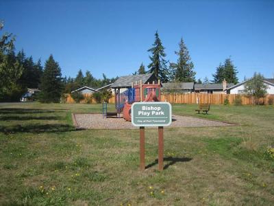
Bishop Park/Bishop Play Park
General Location
Between Sims Way and Parkside Drive with a landscaped addition between Hancock Street and Memory Lane
General Description
Bishop Park proper will remain primarily open space with trails; no additional facilities are planned in the interior. Adjacent property at Parkside Drive is under development as a small neighborhood park in 2014.
History
In April 1966, William and Astrid Bishop recorded their intention to “dedicate to the use of the public forever all streets, avenues, places and parks...” in their plat of Bishop’s Park Addition. The William Bishop Park and its trails are clearly delineated on the plat map. In 1990, two adjoining 40 x 100 foot lots (lots 45 and 46) on the western perimeter were added to the park through the considerable efforts of private citizens and council members. A third lot was added in 1993 (lot 47) as well as easements for water management across other lots in the area. A final lot (44) was purchased in 1999 to complete the western boundary of the park (as described in Resolution 99-003). Bishop Park is the northern expression of a ravine that drains into Port Townsend Bay. The importance of Bishop Park to storm drainage can be readily observed in the City’s stormwater basin map, where Basin #11 is called ‘Bishop Park’ and includes nearly 200 acres.
Foot paths wind along the ravine through the understory of salal, sword ferns and Oregon grape under mature native trees including Big-leaf Maple, Red Alder and Douglas Fir. Adjacent to Sims Way, this has been the only City parkland in the rapidly developing southwest portion of town. Landscaped property north of Parkside Drive will bring play equipment for small children, benches, picnic tables, bicycle rack and other amenities to an underserved neighborhood.
Total Acreage:
4.20 acres


